Weather
How Old Is the Radar on Your EFB? Older Than It Says
August 28, 2026 · 9 min read · by Vincent Wu, Founder, Ascent EFB
Try Ascent EFB
Free for 30 days, then $59.99 your first year
One plan with everything in it: 3D terrain, geo-referenced FAA charts, the full weather stack and live traffic, all cached offline. $89.99 a year after the first. One trial per account, no card needed to look around.
Start a 30-day trialBy Vincent Wu, founder of Ascent EFB. Last updated August 28, 2026.
TL;DR: The timestamp next to the radar layer on your tablet counts the age of the mosaic picture. It does not count the age of the weather drawn inside it. NTSB Safety Alert SA-017 says the weather is ALWAYS older than the number on the display, and that in extreme cases the oldest data in the mosaic can be 15 to 20 minutes older than what the cockpit shows. That happens upstream of every electronic flight bag, ours included. No app fixes it. What helps is reading the number differently, and we think apps should label data age far more honestly.
How old is the NEXRAD radar image on my EFB?
The timestamp on your EFB radar is the age of the mosaic image, not the age of the weather in it. NTSB Safety Alert SA-017 says actual conditions are always older than the displayed number, and in extreme cases can exceed it by 15 to 20 minutes. That is true on every EFB, including ours. The delay happens upstream.
What the number on your screen is actually counting
NEXRAD is a network of ground radar sites. Your app does not talk to them. A service provider takes returns from many sites, stitches them into one composite picture, and broadcasts it over FIS-B or satellite. Your EFB draws the picture it was handed and stamps it with the time that picture was made.
SA-017 puts it plainly: "The age indicator associated with the mosaic image on the cockpit display does not show the age of the actual weather conditions as detected by the NEXRAD network. Instead, the age indicator displays the age of the mosaic image created by the service provider."
So the clock starts when the picture gets assembled. Everything before that is already baked in and invisible: the radar sweep, the trip from the site to the provider, the wait for the next mosaic cycle. A fresh mosaic does not even mean fresh data from every site. SA-017 again: "When a mosaic image is updated, it may not contain new information from each ground site."
| What you see | What it means | What it does not mean |
|---|---|---|
| "2 min" next to the radar layer | The composite image was built 2 minutes ago | That the returns in it are 2 minutes old |
| A brand new frame appears | Your app received a newer mosaic | That every radar site in it reported again |
| A clean gap between two cells | Where the gap was when the data was collected | Where the gap is now |
| A cell painted 15 nm off your nose | Where that cell was some minutes ago | Where it is at this moment |
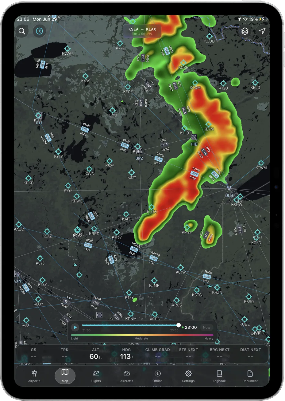 Our radar layer carries a timestamp like everyone else's, and that timestamp has exactly the problem described here.
The NTSB put real numbers on the gap
SA-017 was issued June 2012 and revised December 2015. It exists because the NTSB investigated two fatal accidents where the pilot had cockpit NEXRAD near fast moving convective weather.
In the first, a Eurocopter AS350 B3 near Brownsville, Tennessee on March 25, 2010, the display received an image labeled about 1 minute old. The weather in it was about 5 minutes old. The image put severe weather roughly 7 miles from the home base the pilot was trying to land at. It was actually crossing over that base at about the time the image arrived.
In the second, a Piper PA-32-260 near Bryan, Texas on December 19, 2011, the last three NEXRAD updates the pilot received should each have read 1 minute old. The actual conditions in them were about 6, 7 and almost 8 minutes old.
Those are the ordinary cases. The outlier is the headline number: "in extreme latency and mosaic-creation scenarios, the actual age of the oldest NEXRAD data in the mosaic can EXCEED the age indication in the cockpit by 15 to 20 minutes."
It also takes a swing at the rule of thumb most of us were taught: "Understand that the common perception of a '5-minute latency' with radar data is not always correct."
And the line I keep coming back to: "Weather conditions depicted on the mosaic image will ALWAYS be older than the age indicated on the display."
Source: NTSB Safety Alert SA-017, In-Cockpit NEXRAD Mosaic Imagery, read August 28, 2026.
This one lands on us too
Ascent does not have fresher radar than anyone else. We receive the same NEXRAD mosaic products from the same pipeline, and the timestamp in our app carries the gap SA-017 describes. SA-017 is written about in-cockpit NEXRAD mosaic imagery generally, over both FIS-B and satellite delivery, so it is not about any one product. No app can render data it has not been sent.
If you are comparing apps on radar, the thing to compare is how each one labels the age of what it is showing you. The data itself arrives the same way.
Pilots have been noticing for years, and their estimates are all over the place
On Pilots of America, a thread titled "Bogus NEXRAD?" opens with Jay Honeck asking, on September 28, 2012: "Is it just me, or have NEXRAD displays become even more wildly inaccurate?" He describes green and yellow splotches over South Texas with no rain observed, and a flight home from Oshkosh where popcorn rain was painted along a 1300 mile route and they saw one light shower.
In a separate Pilots of America thread, "Some ADS-B weather questions", user chemgeek wrote on July 6, 2020: "a NEXRAD composite picture will always be a minimum of 20 min. and perhaps 40 min. old."
I am quoting those, not endorsing them. The 20 to 40 minute figure is one pilot's understanding on a forum, and it is not a number the NTSB publishes. But the spread itself is the useful signal. Careful pilots are working from very different mental models of how stale this picture is. Some think 5 minutes. Some think 40. The display gives them nothing to calibrate against. That is a user interface problem as much as a data problem.
How to read the number differently
None of this makes datalink radar useless. It makes it strategic rather than tactical. Here is how I read it now.
| Habit | Why |
|---|---|
| Treat the picture as where the weather WAS | SA-017's own wording. It is the whole point of the alert. |
| Add margin on top of the displayed age, not zero | The displayed number is a floor, never the total |
| Scrub the loop instead of staring at one frame | Motion and trend survive latency better than position does |
| Extrapolate the cell forward past the newest frame | A 40 knot cell moves about 7 nm in 10 minutes |
| Never use it to thread a gap between cells | The gap you see is the oldest thing on the screen |
| Cross check with your eyes, ATC, Flight Service, PIREPs | SA-017 asks for all appropriate sources, not one |
| Get a real preflight briefing anyway | SA-017 is explicit that cockpit weather does not replace it |
The loop is the one that changed my own flying. A single frame tells you position, which is the piece latency ruins first. The loop tells you direction and rate of build, which decays much more slowly. If a line is walking east at a steady clip across four frames, that trend is still true five minutes after the last frame was made. Where exactly the leading edge sits right now is not.
Our aviation weather briefing guide puts radar in its place next to METARs, TAFs, winds aloft, PIREPs and AIRMETs.
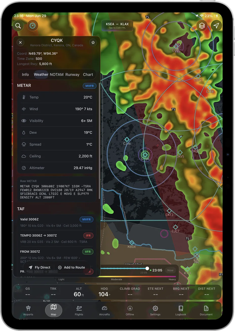 Surface observations carry an honest observation time. Radar mosaics are the layer where the timestamp misleads.
What we think EFBs should do about it
This is a note to ourselves as much as anything, because we follow the same convention as everyone else.
Our radar layer shows a frame timeline with times on it and a Now marker. That beats a bare "2 min ago" badge, because you can see the frame you are looking at against the current clock. It still inherits the upstream gap and it does not say so.
What we would rather build toward is simple. Label the frame with its valid time instead of a countdown. Put "where the weather was" in the interface rather than in a safety alert from 2012 that a pilot has to remember. And stop implying precision the product does not have. A number rendered to the minute reads as accurate to the minute.
We are not claiming that as an advantage over anyone. It is a change we want to make in our own app, and we have not made it.
The short version
- The age indicator counts the mosaic, not the weather.
- The weather is always older than that number, per SA-017, and in extreme cases by 15 to 20 minutes.
- The 5 minute latency rule of thumb is not reliable.
- The delay happens upstream of your app, before any EFB gets the data.
- Use the loop for trend. Do not use a single frame for clearance from a cell.
Frequently asked questions
Is the radar in Ascent EFB fresher than in other apps?
No. We receive the same NEXRAD mosaic products through the same pipeline everyone else does, and the latency described in SA-017 applies to us the same way.
How old is NEXRAD data on an EFB, really?
You cannot know from the display. SA-017 says actual conditions are always older than the age shown, and that in extreme cases the oldest data in the mosaic can exceed it by 15 to 20 minutes. Treat the displayed number as a minimum.
Can I use datalink radar to pick my way between cells?
No. Position is the first thing latency destroys, and a gap on the screen is the oldest information on it. Airborne radar and your eyes are the tactical tools. Datalink is for the strategic decision to go around, hold, or land.
Does this apply to ADS-B FIS-B weather and satellite weather both?
Yes. SA-017 covers mosaic imagery delivered over FIS-B and by private satellite providers, and notes the maximum age difference varies by service type and provider.
What does Ascent EFB include for weather?
METARs, TAFs, radar, winds aloft, AIRMETs and SIGMETs, in one plan and cached for offline use. More in what is Ascent EFB, and a wider look at the category in the best EFB apps of 2026.
Written by Vincent Wu, founder of Ascent EFB at Geospatios. Every NEXRAD latency claim and quotation here comes from NTSB Safety Alert SA-017, In-Cockpit NEXRAD Mosaic Imagery, issued June 2012, revised December 2015, read August 28, 2026. Community quotations are attributed to their threads and dates and are the opinions of those posters, not verified fact. Ascent EFB is our product, so treat our opinions about it as ours. Any EFB is a supplemental aid to situational awareness, and final authority rests with the pilot in command.
Try Ascent EFB
Free for 30 days, then $59.99 your first year
One plan with everything in it: 3D terrain, geo-referenced FAA charts, the full weather stack and live traffic, all cached offline. $89.99 a year after the first. One trial per account, no card needed to look around.
Start a 30-day trial