Guides
Does a Wi-Fi iPad Have GPS? No. Here Is the Fix
August 28, 2026 · 9 min read · by Vincent Wu, Founder, Ascent EFB
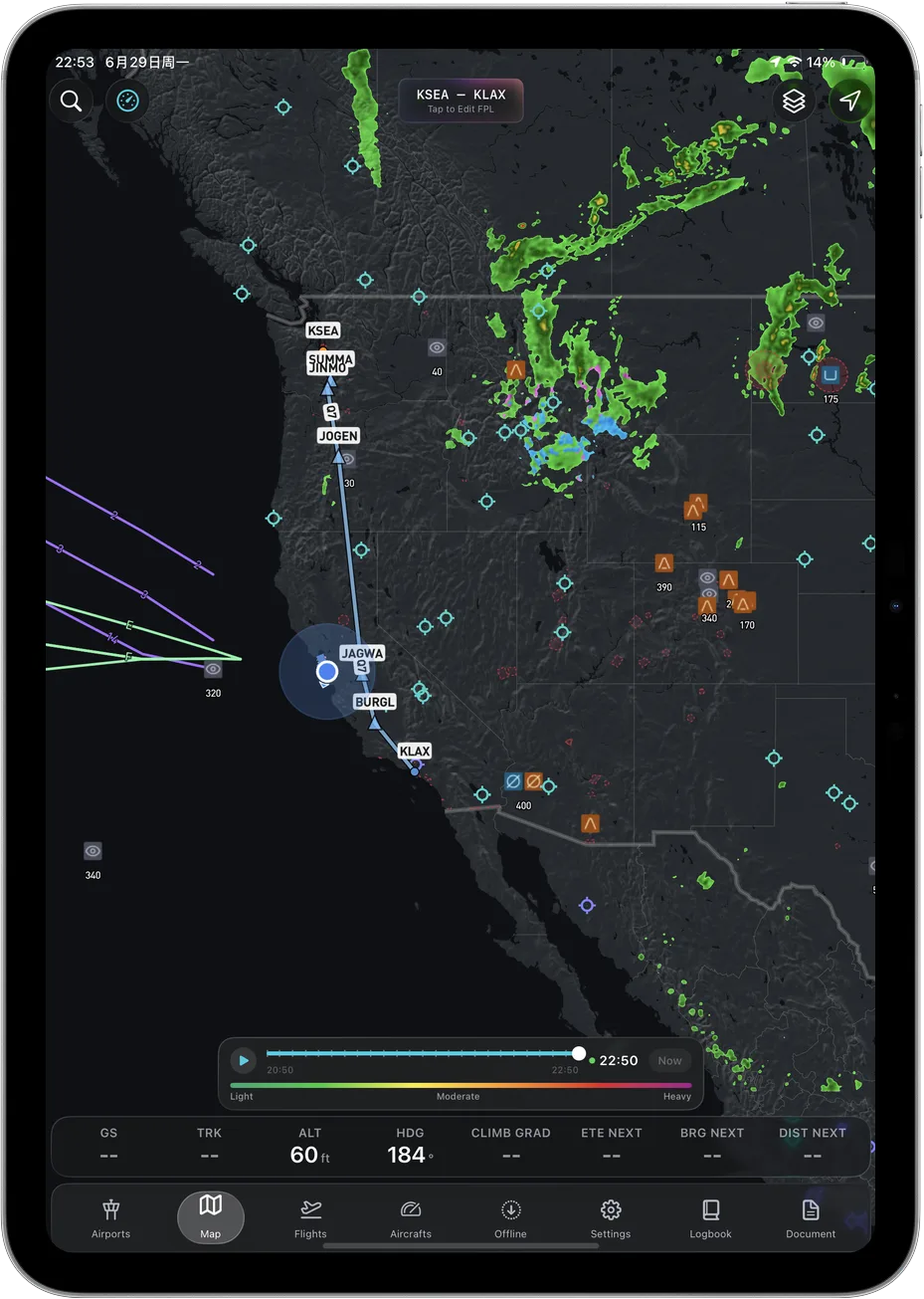
Try Ascent EFB
Free for 30 days, then $59.99 your first year
One plan with everything in it: 3D terrain, geo-referenced FAA charts, the full weather stack and live traffic, all cached offline. $89.99 a year after the first. One trial per account, no card needed to look around.
Start a 30-day trialBy Vincent Wu, founder of Ascent EFB. Last updated August 28, 2026.
TL;DR: A Wi-Fi-only iPad has no GPS receiver in it. Apple lists GPS/GNSS only under the Wi-Fi + Cellular models. Put a Wi-Fi iPad in an airplane and your charts still draw, but your airplane does not move on them. Three fixes: buy the cellular model, pair a Bluetooth GPS puck, or pair a portable ADS-B receiver with a WAAS GPS built in. You do not need to activate a cellular plan for the built-in GPS to work. And the cellular iPad does not make your position bulletproof either. Caveats below.
Does a Wi-Fi-only iPad have GPS?
No. Apple's published iPad specifications list GPS/GNSS only under the Wi-Fi + Cellular models. Wi-Fi-only iPads list digital compass, Wi-Fi and iBeacon microlocation, none of which work in an airplane. To get a moving map you need a cellular iPad, or an external GPS or ADS-B receiver paired to the tablet.
This is the most argued question in general aviation forums, and it keeps getting re-argued because the answer sounds wrong. Every iPhone has GPS. Your Wi-Fi iPad shows you on a map at home. So people conclude the hardware is in there and just needs a signal. It is not in there.
What Apple actually publishes
Open the specs page for whichever iPad you are looking at and scroll to the Location section.
| iPad model | Location hardware Apple lists | Moving map in flight |
|---|---|---|
| Wi-Fi | Digital compass, Wi-Fi, iBeacon microlocation | No |
| Wi-Fi + Cellular | The above, plus GPS/GNSS and Cellular | Yes |
Read from apple.com/ipad-11/specs and apple.com/ipad-pro/specs on August 28, 2026. Both list it the same way. Check the page for your exact model, because Apple changes lineups constantly.
The part that trips people up: you do not need a data plan. The GPS chip in a cellular iPad works with no SIM, no activated line, in airplane mode. It is a separate receiver that only ships in the cellular SKU. You are paying roughly $150 more for a GPS receiver bundled with a modem you may never turn on.
The r/flying PSA on this ("The WiFi only iPad does not contain a GPS receiver," 342 upvotes, 165 comments) exists because pilots keep buying the wrong one. Go read it before you order.
So how does your Wi-Fi iPad know where you are at home?
It is cheating, and the cheat does not work in the air. iOS falls back to Wi-Fi positioning: the device sees nearby networks, sends that list to Apple, and gets back a position from a database of where those networks are. In a dense neighborhood it is good to a block or so, and it feels like GPS. At 4,500 feet over farmland there are no networks to see.
What actually happens to your moving map with no GPS
The failure is not a clean error message, which is what makes it worth understanding.
Your charts still draw. Sectionals, terminal area charts, IFR enroute charts, taxi diagrams, airport data. All cached, none of it needs position to render. So the app looks fine.
Your airplane symbol does not move. You get one of three behaviors: the ownship symbol disappears, it jumps somewhere absurd, or it sits frozen wherever the tablet last had a real fix. That last one is the dangerous case, because a symbol parked on the departure ramp looks plausible for the first ten minutes.
Everything derived from position dies with it. Ground speed, track, distance and time to the next fix, ETA, nearest airport, track-up orientation, terrain awareness tied to where you actually are, your position on the taxi diagram. None of that is chart data. All of it is computed from a live fix.
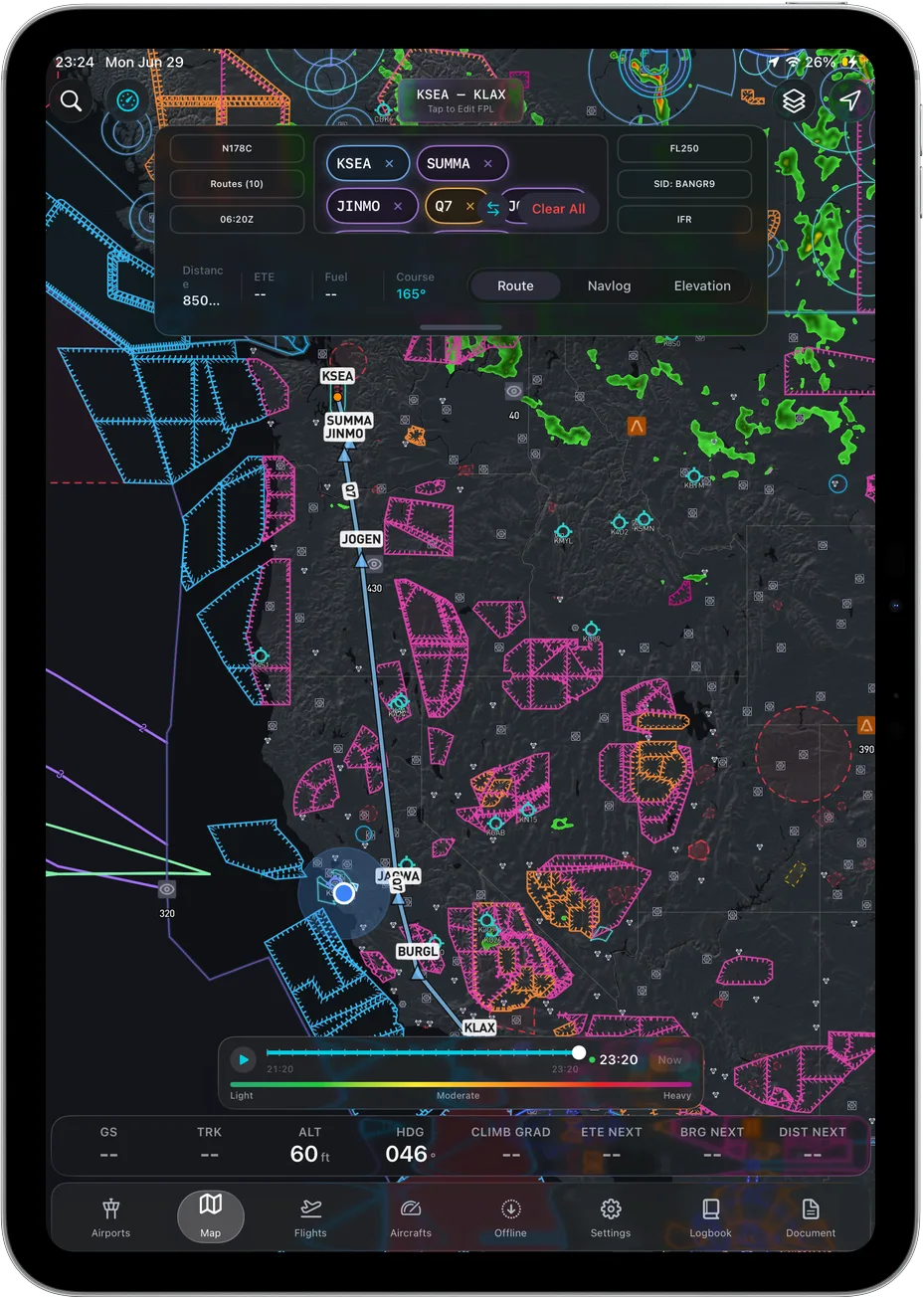 Route and airspace draw from cached data. The airplane on top of them does not.
A Wi-Fi iPad turns a moving map into a very good digital chart binder. Still useful. Not what you thought you bought.
The altitude caveat, handled honestly
Buying the cellular model is the right answer, but it does not make the problem disappear. From the same r/flying thread, one commenter wrote:
"at certain altitudes, usually around 5,000 feet MSL, the built-in GPS becomes unreliable"
I am quoting that as a report from the thread, not restating it as fact. I went looking for a vendor or FAA source documenting a specific altitude where iPad GPS degrades, and I did not find one. So I am not going to print it as our claim.
What I can say is that the iPad's antenna is small and buried in a tablet designed for someone walking down a street with the whole sky above them. Clamped to a yoke in a metal cabin, or flat on your leg, it has a poor view of the sky and a lot of aluminum in the way. Reception drops out and comes back. Whether that correlates with altitude or with where the tablet is sitting, I cannot prove from a source. The fix is the same either way: get a receiver with a better view of the sky than a tablet on your knee.
Your three options, and what each one costs you
| Option | What you get | The trade |
|---|---|---|
| Wi-Fi + Cellular iPad | Built-in GPS/GNSS, no extra box, nothing to charge | Roughly $150 more, cannot be added later, antenna sits inside the tablet |
| Bluetooth GPS puck | Position for any iPad, and it can go on the glareshield for a clear sky view | Another device to charge and remember, and it gives position only |
| Portable ADS-B receiver with built-in GPS | Position, plus ADS-B traffic and FIS-B weather | Most expensive, biggest box |
On the receiver options, from the vendors' own pages, read August 28, 2026:
- uAvionix Sentry. ForeFlight's Sentry support page states "Sentry has a built-in WAAS GPS for the display GPS data in ForeFlight Mobile, including aircraft position, altitude, ground speed, and more," plus antennas for 978 MHz and 1090 MHz and an integrated CO monitor (foreflight.com/support/sentry).
- Garmin GDL 50. Garmin's own product material says it "includes a built-in WAAS GPS receiver, which enables it to deliver highly accurate aircraft position, speed and altitude information to your compatible mobile device app," with up to 8 hours of battery (garmin.com).
- Bad Elf. Bad Elf's site says the company "pioneered Apple's MFi program, offering the first approved GPS accessory for the iPhone in 2010," and that its units Bluetooth pair with the tablet (bad-elf.com).
I am not going to tell you which to buy. I have not bench-tested them against each other, and if I have not tested it I am not ranking it. The ADS-B units do solve two problems at once, so if you already wanted traffic and weather, the GPS comes along with it.
One detail worth knowing: Apple's MFi program is what lets an external GPS accessory replace the iPad's own location source system-wide, so every app on the tablet gets the external position. Non-MFi receivers generally feed one app directly instead. Both work. Just know which you have, so you are not surprised when your backup app shows no position while your primary one is happy.
Test it on the ground, not at 3,000 feet
Twenty minutes on the ramp beats any forum thread, including this one.
- Put the iPad in airplane mode. With an external receiver, turn Bluetooth back on and pair it.
- Open your EFB and confirm a GPS status indicator showing a real fix, not a last-known position.
- Taxi and watch the symbol move on the airport diagram. A frozen symbol on a moving airplane is the failure mode you are hunting for, and it is obvious at 10 knots.
- Mount the tablet where it will actually live in flight, then check again. Reception on the passenger seat and reception clamped to a yoke are not the same thing.
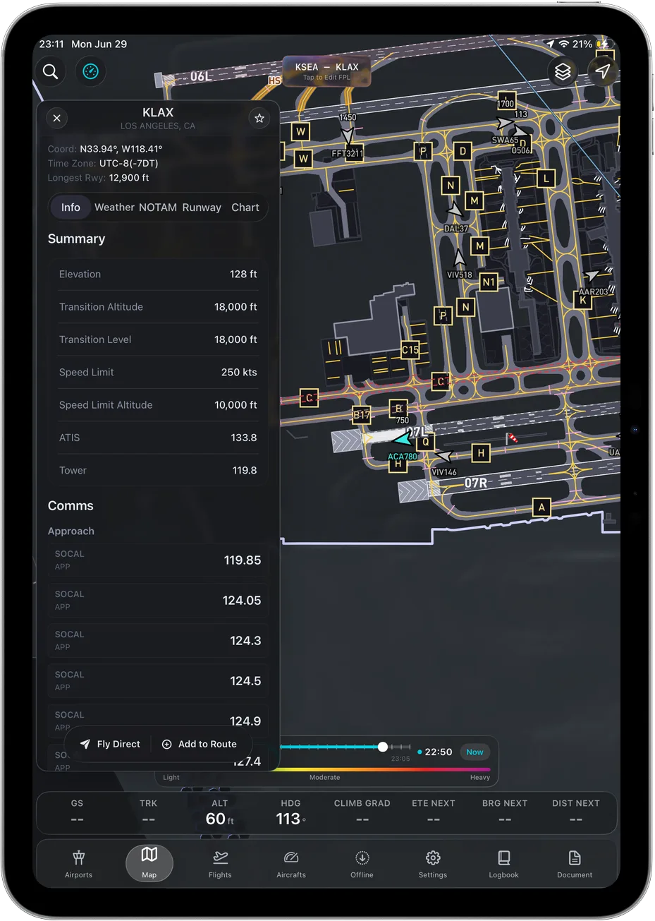 If your ownship symbol tracks correctly while taxiing, your GPS chain is working. Do this check on the ground.
What to do when GPS drops in flight
It will happen eventually, on any tablet, with any app. Fly the airplane. Fall back to the panel and to pilotage. Your cached charts are still correct, so you have a chart binder again. Note last known position and time, then use heading and time until the fix returns.
Which is why offline caching matters more than most pilots weight it. It is what stands between you and a blank screen when position and connectivity go away together, and one reason we cache the whole map, terrain and airport dataset to the device in Ascent EFB rather than streaming tiles.
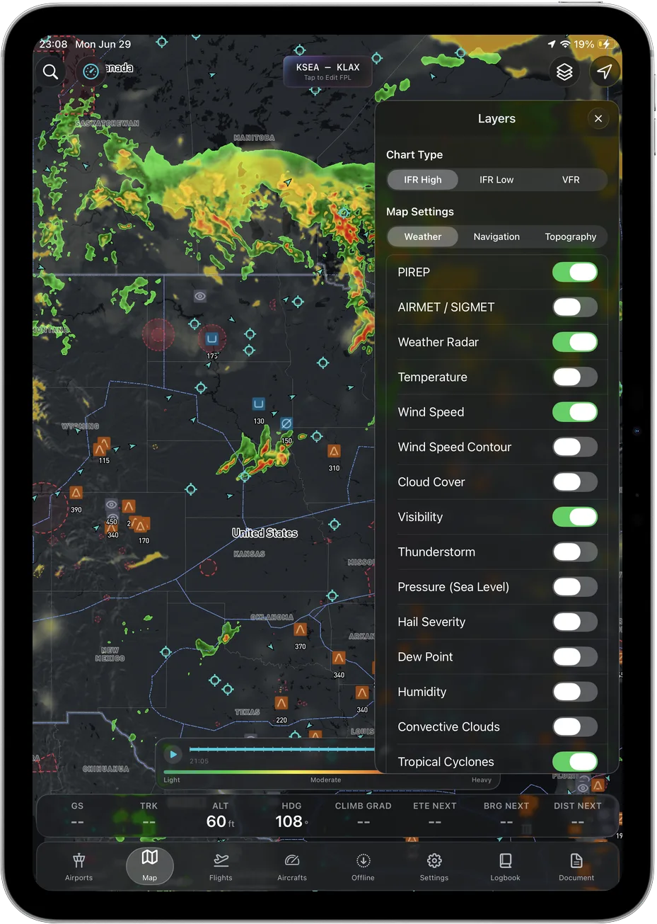 Cached layers keep drawing with no signal and no fix. Only the airplane on top of them needs GPS.
None of this makes an EFB a primary navigation source. It is a supplemental aid, and an examiner may well ask what happens when it quits. Have an answer before somebody asks for one.
The short version
Buy the cellular iPad and skip the data plan. If you already own a Wi-Fi one, add an external receiver and mount it where it can see sky. Then test the chain on the ramp.
Still choosing an app? We wrote up the best EFB apps of 2026, what an EFB actually costs, a longer guide to choosing an EFB, and how to build a weather briefing.
Frequently asked questions
Do I need a cellular data plan for iPad GPS to work?
No. The GPS/GNSS receiver in a Wi-Fi + Cellular iPad works with no SIM, no active line and no coverage. You are buying the hardware, not the service.
Can I add GPS to a Wi-Fi-only iPad?
Yes, with an external receiver. Either a Bluetooth GPS puck or a portable ADS-B receiver with a built-in WAAS GPS. Both vendor categories publish that capability on their own product pages, read August 28, 2026.
Will an iPhone hotspot give my Wi-Fi iPad a position?
No. Tethering shares data, not location. The iPhone itself does have a real GPS receiver, which is why plenty of pilots run an EFB on the phone as a backup.
Why does my Wi-Fi iPad show my location at home?
iOS estimates position from nearby Wi-Fi networks when there is no GPS. On the ground in a populated area that is close enough to feel like GPS. In flight there are no networks in range.
Does Ascent EFB need a connection to work?
No. Charts, 3D terrain and airport data cache to the device, and the last weather you pulled stays available, so the app works in airplane mode. It still needs a GPS fix from somewhere to show your position.
Written by Vincent Wu, founder of Ascent EFB at Geospatios. All read August 28, 2026: iPad location hardware from apple.com/ipad-11/specs and apple.com/ipad-pro/specs, Sentry from foreflight.com/support/sentry, GDL 50 from Garmin's own product material, and the MFi statement from bad-elf.com. Community quotes are quoted as posted by their authors and are not our own factual claims. Specs and lineups change, so verify before you buy. Any EFB is a supplemental aid to situational awareness, and final authority rests with the pilot in command.
Try Ascent EFB
Free for 30 days, then $59.99 your first year
One plan with everything in it: 3D terrain, geo-referenced FAA charts, the full weather stack and live traffic, all cached offline. $89.99 a year after the first. One trial per account, no card needed to look around.
Start a 30-day trial